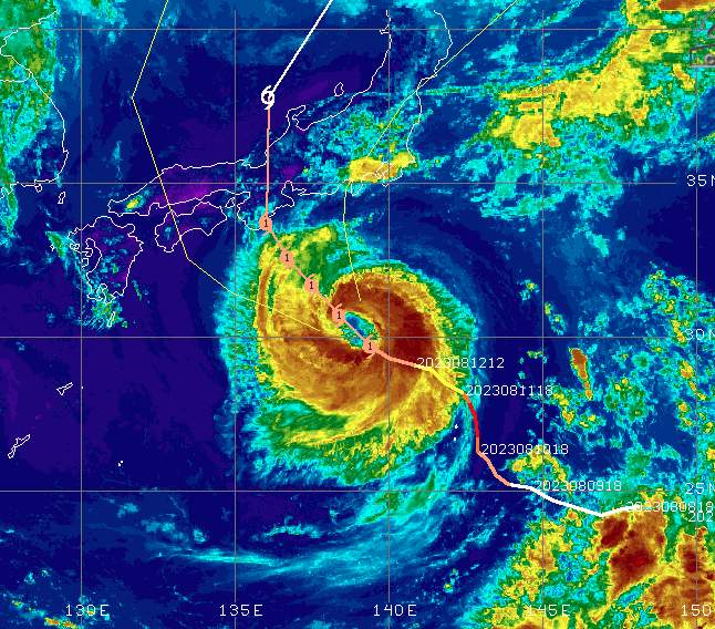
Over the past few days, a tropical depression has formed west of the Timor Sea, followed by a cyclone. Ilsa – - the name of the tropical storm - will continue to intensify over the next two days before making landfall on the northern coast of Western Australia.
Origin and history
From the beginning of April, global weather models suggested the possible development of a tropical storm between Australia and Indonesia by the middle of the month. It is understandable that forecasts over such a long time horizon are fraught with uncertainty. But in the last few days, this trend has manifested itself and finally a tropical depression formed on Easter Monday. This is the precursor to a tropical storm, also called a cyclone in this region. (Not to be confused with a cyclone, which in the jargon describes an ordinary depression). More information and differences between tropical and extratropical depressions can be found on this blog, among others).
As soon as such a system reaches the status of a tropical storm, it is designated by the respective responsible departments. The current cyclone has been named Ilsa. Ilsa currently has average winds of 130 to 150 km/h, which makes it a second category cyclone (out of 5) on the Saffir-Simpson scale (on the Australian tropical storm scale, these winds already correspond to the average wind speed of a tropical storm).(On the Australian Tropical Storm Scale, these winds are already at level 3 out of 5, although there are some differences not explained in the general definition). It is currently less than 500 kilometers northeast of Port Hedland and moving southwest at about 10 kilometers per hour.
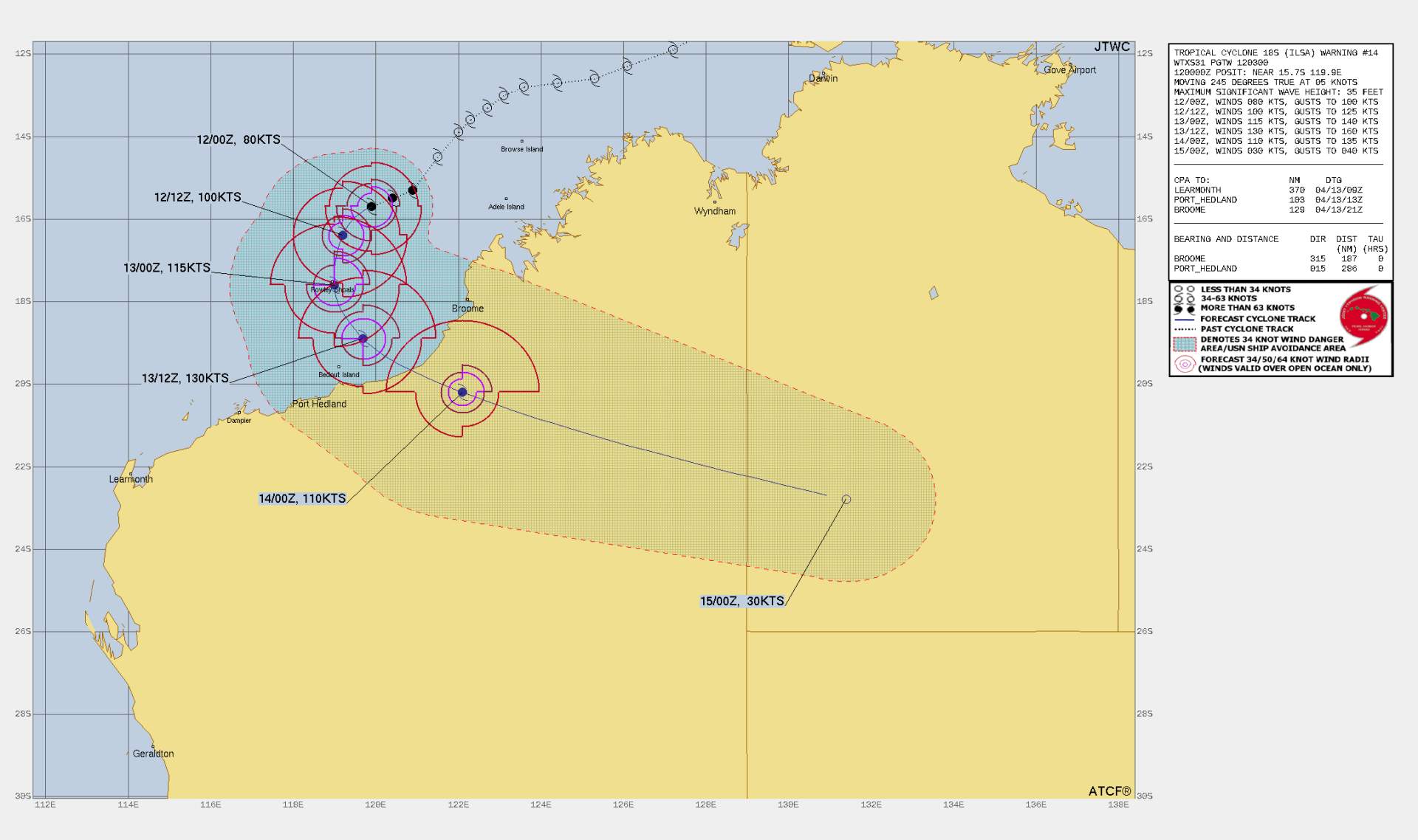
Fig. 1: Other trajectory of Ilsa with expected wind forces in time; Source: Joint Typhoon Warning Center
Progress and Evolution
The models are unanimous on the continuation of the trajectory. According to them, after the current south-westerly drift, it will first move south from tomorrow, then southeast, where it will probably make landfall on Friday (local time) between Port Hedland and Broome. It is certain that Ilsa will continue to strengthen on this route over the water, but the models are not yet in agreement on the intensity of this strengthening. This is primarily due to a slightly different track, which gives the storm more or less time to intensify. According to the latest data from the U.S. global model (GFS), the cyclone is expected to have a central pressure of 930 to 940 hPa when it makes landfall. The European model (ECWMF) predicts a minimum pressure of about 960 hPa, but also an earlier landfall of several hours. The German ICON model presents an even more urgent, but rather unlikely variant. According to this model, the cyclone would make landfall as early as Thursday evening with a central pressure of about 970 hPa. Depending on the scenario, average winds of between 160 and nearly 200 km/h can be expected along the affected coast.
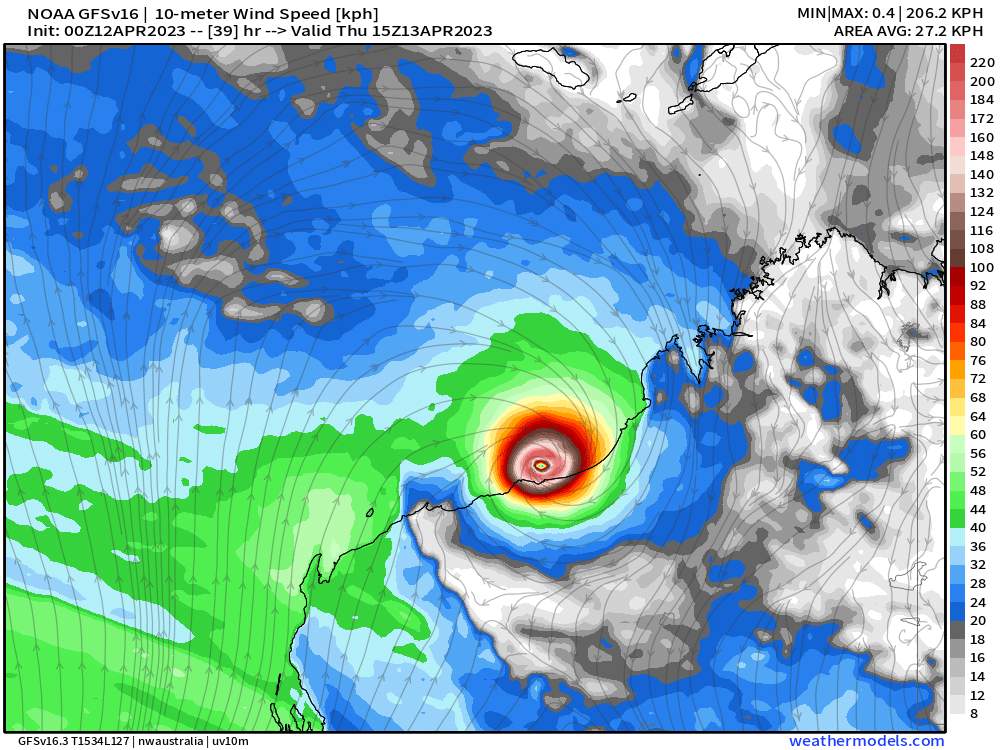
Fig. 2: Wind speeds at 10 meters altitude early Friday morning (local time) according to the GFS.; Source: weathermodels
The reasons for a rapid strengthening
For a tropical storm to develop well and quickly, there must be an input of energy from the warm sea surface, and the winds must not vary too much from one another at different altitudes (wind direction and speed; wind shear). Ideally, the top layer of water should have a temperature of at least 26-27 degrees. As shown in the map below, values above 30 degrees are currently measured in the region. Similarly, the wind shear in the immediate vicinity of the storm center has extremely low values (bottom map).
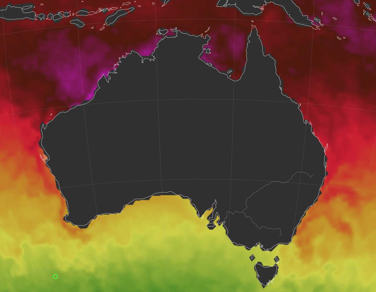
Fig. 3: Water surface temperatures (reddish tones > 25 degrees, violet-pink > 30 degrees); Source: Earth Nullschool (dargestellte Daten von UK Met Office)
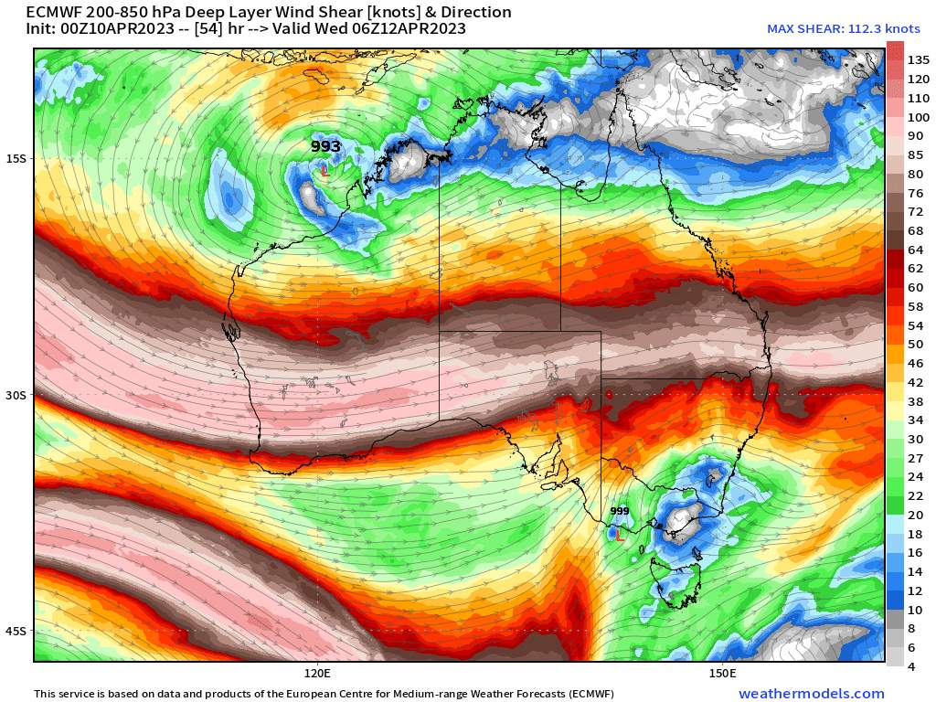
Fig. 4: Wind shear in the troposphere according to ECMWF (the lower the values, the more the cyclone can develop); Source: weathermodels
Hazards of Ilsa
In addition to the strong winds, heavy rainfall is to be expected in the tropical systems. In a relatively small area, more than 200 mm of rain is expected in the next few days. This may not seem like much at first glance, but if you look at the region, this corresponds in some areas to more than half the typical annual rainfall. For example, about 315 mm of rain falls annually in Port Hedland (for comparison, the annual average is about 1000 mm in the Swiss Plateau and 1200 to 1300 mm in Switzerland as a whole). In this dry climate, such intense precipitation generally cannot be well absorbed by the soil, so that much of the water runs off the surface and can cause flash floods.
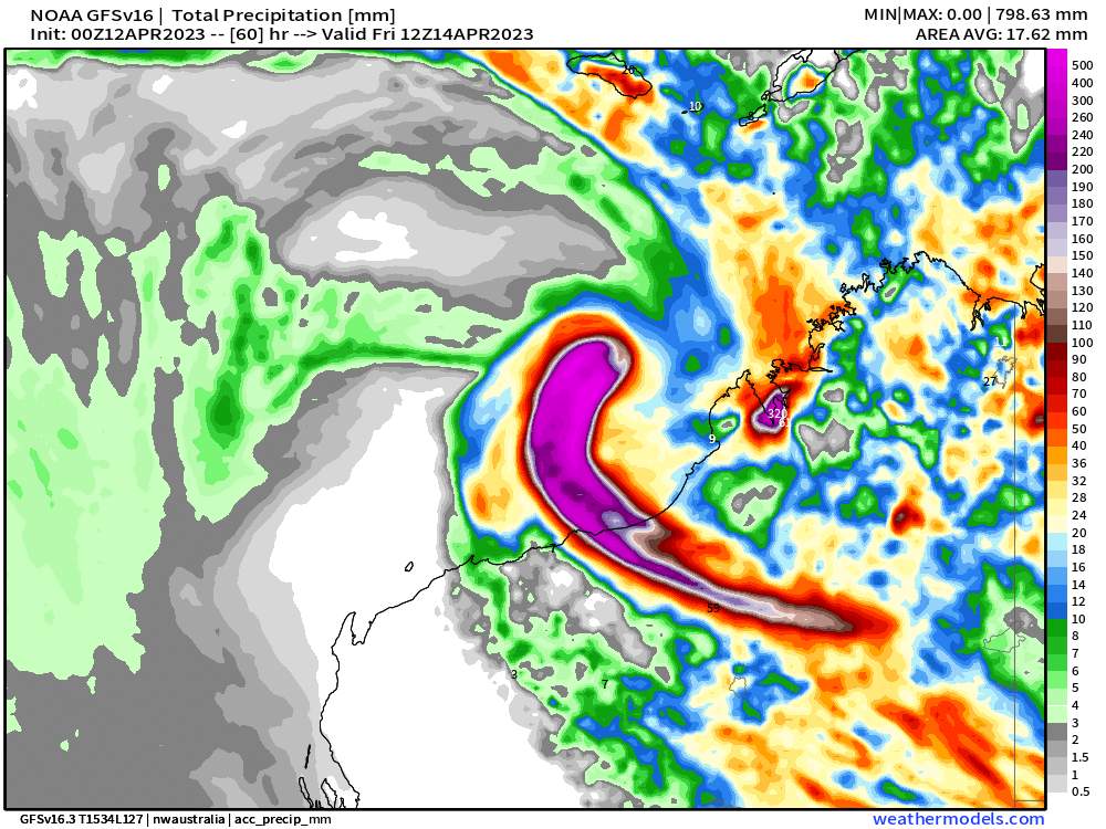
Fig. 5: Rainfall amounts expected in the next 60 hours according to the GFS; Source: weathermodels
Another factor that should not be overlooked in the coastal region is the high swell caused bythe storm. As shown in the illustration below, waves of 10 to 15 meters can be expected in the affected part of the coastline. In addition to coastal erosion, such rough seas also pose a challenge to one of the world's largest bulk cargo export ports, Port Hedland.
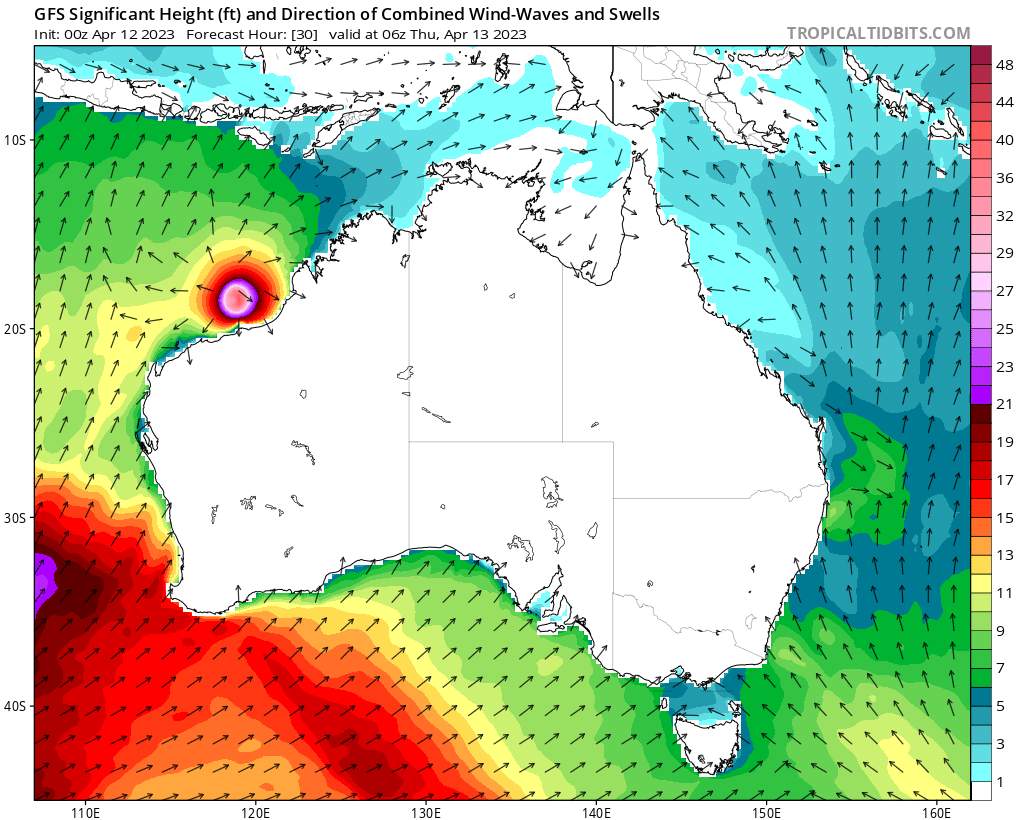
Fig. 6: Wave heights just before landfall of Cyclone Ilsa according to the GFS; Source: Tropical Tidbits
Climatology of tropical storms in the Australian basin
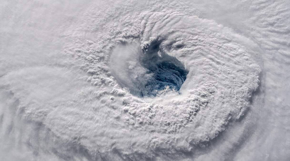
The Australian Basin includes parts of the southern Indian Ocean and the southern Pacific Ocean. It is typically the area between 90 and 160 degrees East longitude. The tropical storm season officially begins on November 1 and lasts until the end of April, although storms can form out of season (usually south of Sumatra). Data are recorded in detail from the 1969/70 season. During this period, an average of eleven tropical storms formed annually in Australian waters, four of which made landfall. Since the beginning of the millennium, the trend has been downward, with an average of nine tropical storms per season. Ilsa is the sixth cyclone named this season. In February, Cyclone Freddy had already made headlines, setting a new world record as the most energetic tropical storm.
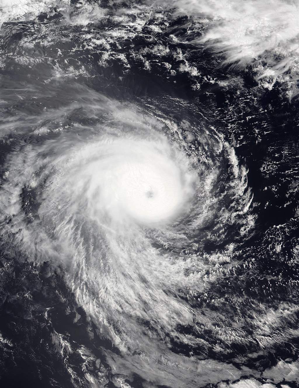
Fig. 7: Cyclone Freddy over the Western Indian Ocean on February 12; Source: Wikipedia
disclaimer
The content of this article has been at least partially computer translated from another language. Therefore, grammatical errors or inaccuracies are possible. Please note that the original language version of the article should be considered authoritative.


